
What CloudCompare is
CloudCompare is a free, open-source program for opening, analysing and editing point clouds and 3D meshes. It began in 2003 as part of Daniel Girardeau-Montaut’s PhD on change detection in 3D data, a collaboration between Télécom ParisTech and the R&D division of EDF, the French utility. Hence the name: it was designed to compare dense clouds captured with laser scanners. Today it is an independent open-source project released under the GNU GPL.
If you are not sure exactly what you have received, start with what a point cloud is: what each point stores, what accuracy to expect and which formats it comes in.
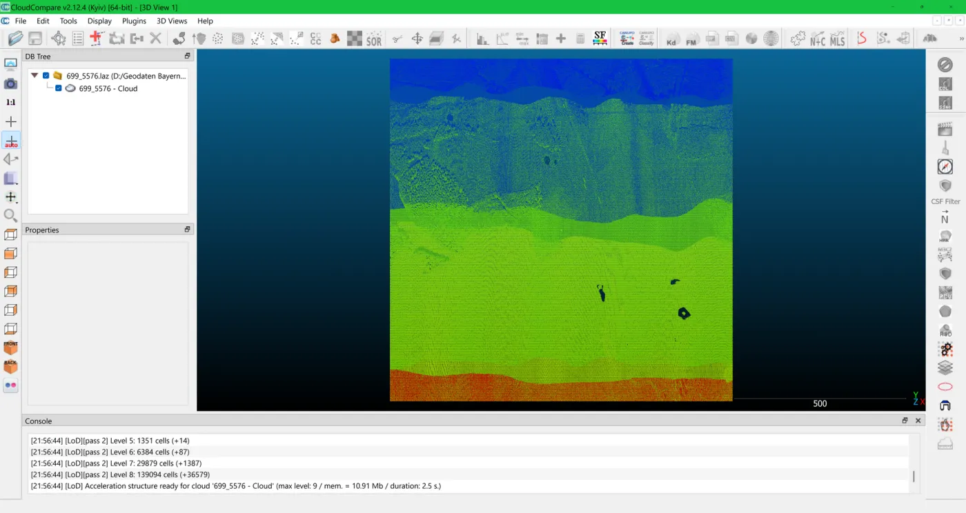
Download and installation
Always download it from the official website, cloudcompare.org, on its downloads page:
- Windows: 64-bit installer or a portable version in a compressed archive.
- macOS: the official site links to the Apple silicon and Intel build maintained by a project contributor.
- Linux: package on Flathub (
org.cloudcompare.CloudCompare).
As of September 2026 the stable release is 2.13.2 and 2.14 is in beta. For production work, use the stable one. ccViewer, a lightweight viewer for people who only want to look at the cloud, is distributed alongside CloudCompare.
When you open a georeferenced cloud (UTM coordinates, in the millions of metres), CloudCompare suggests a global shift. Accept it: it works internally with smaller coordinates so as not to lose precision, and restores the originals on export, as long as the format supports it. Declining it can degrade precision to centimetre level.
Which formats it opens (and which it does not)
According to its official documentation, it reads and writes dozens of formats. The ones you will see most in a survey:
| Format | What it is | In CloudCompare |
|---|---|---|
E57 | Neutral 3D scanning format (ASTM E2807) | Read and write |
LAS / LAZ | LiDAR and surveying standard; LAZ is compressed | Read and write |
PLY | Cloud or mesh, common in photogrammetry | Read and write |
PTX / PTS | Text-based scanner exports | PTX read only; PTS both |
OBJ / STL / FBX | 3D meshes | Read and write |
DXF / SHP | CAD and GIS (sections, contours) | Read and write |
RCP / RCS | Autodesk ReCap’s own format | Not supported |
IFC / RVT | BIM models | Not supported |
The practical upshot: if someone delivers the cloud only as RCP, you will not be able to open it in CloudCompare. Always ask for a copy in E57 or LAS/LAZ, open formats that any serious program can read.
What surveyors and engineers use it for
All of these tools are in the standard menus, with no paid add-ons (menu paths from the official list of methods):
Measuring
Tools > Point Picking lets you pick points and get coordinates, point-to-point distances (with their X, Y, Z components), angles and areas. It is what clients use most: checking a clear height, a clearance gauge or whether a piece of equipment fits through an opening, without going back to site.
Cutting sections
Tools > Segmentation > Cross Section clips a slice of the cloud with a box you can move and rotate, and Extract Sections produces profiles that can be exported to DXF to continue in CAD. It is the quick way to see a plan or an elevation without waiting for the drawings.
Cleaning and segmenting
The scissors tool (Edit > Segment) lets you split off or delete parts of the cloud by hand: passers-by, cars, surroundings you do not need. The SOR and Noise filter tools (Tools > Clean) remove isolated points and noise automatically.
Lightening the cloud
Edit > Subsample reduces the number of points, for instance by enforcing a minimum spacing between them. A cloud of hundreds of millions of points becomes manageable on a laptop or for linking into another program, at the cost of detail.
Registering and aligning
It can align two clouds using point pairs (Align) and refine the fit with ICP. Useful for fitting a new cloud onto an older one; registering a full survey, with its error report, is done in the scanner software.
Calculating volumes
Tools > Volume > Compute 2.5D volume calculates the volume between a cloud and a plane, or between two clouds, on a grid. It is the standard calculation for stockpiles, quarries and cut and fill.
Cloud-to-cloud and cloud-to-model comparison
This is what gives it its name, and what no BIM viewer does: calculating the distance from every point to another geometry and displaying it as a colour map.
- Cloud to cloud (C2C), under Tools > Distances > Cloud/Cloud Dist. Compares two captures taken on different dates: deformation, construction progress, what has changed. According to the documentation, the reference cloud should be the one with the widest extent and highest density, and the distance is unsigned.
- Cloud to mesh (C2M), under Tools > Distances > Cloud/Mesh Dist. Compares captured reality with a model. Here the distance can be signed, so it tells apart what protrudes from what sits behind the model. It is the quality check for an as-built model, or the way to verify that what was built matches the design.
Since CloudCompare does not open IFC or RVT, the model is first exported to a mesh (OBJ, FBX or STL). And the result needs reading with judgement: the documentation itself warns that you should look at the trend in each area, not at individual points.
What CloudCompare does not do
- It is not BIM or CAD. It does not create walls, slabs or pipes with their properties. For modelling, the cloud is linked into Revit via ReCap, or into Archicad or other tools. We explain it in what Scan to BIM is.
- It does not replace registration software. Joining hundreds of scanner setups with a precision report is done in the manufacturer’s software.
- It is not for sharing. Asking a site supervisor or a client to install a desktop program and load gigabytes just to look at a cloud does not work. That is what a web viewer is for.
- It has a learning curve. It is very powerful, but its interface is built for technical users.
CloudCompare or Autodesk ReCap
They compete less than it seems: in many technical offices they sit side by side. ReCap Pro is Autodesk’s point cloud software; it imports scanner clouds, registers them and indexes them as RCP/RCS, the only point cloud format that Revit and AutoCAD link. It is a paid subscription and is included in the AEC Collection. The same application works for free as a viewer, with measuring, when there is no active subscription, according to Autodesk support.
| CloudCompare | Autodesk ReCap Pro | |
|---|---|---|
| Licence | Open source (GPL), free | Paid subscription; free viewer |
| Platform | Windows, macOS, Linux | Windows |
| Open formats (E57, LAS/LAZ) | Read and write | Imports E57 and LAS; exports E57 |
| RCP / RCS | No | Native format |
| Strength | Analysis: C2C, C2M, volumes, cleaning | Registration and the route into Revit / AutoCAD |
| When to choose it | Reviewing, measuring, checking deviations | Preparing the cloud for modelling in Autodesk |
The rule of thumb: if you are going to model in Revit, you will need ReCap or to be handed the RCP ready-made. If you are going to review, measure or check a model against reality, CloudCompare does more and costs nothing. We do not quote ReCap prices because they vary by country and plan: check them on Autodesk’s website.
What we deliver and how to share it
When you commission 3D laser scanning from LAURIA ESCÁNER, the point cloud is always included, in E57, LAS or LAZ, ready to open in CloudCompare or any program that reads these standards. The rest depends on the brief: RCP for linking into Revit, 2D drawings, the BIM model in IFC and RVT, orthophotos or Gaussian Splatting. We work from Madrid on projects across Europe.
So the rest of the team can view the cloud without installing anything, we publish it on VisionHub: it opens in the browser, can be measured, and is overlaid on the IFC model and on the actual state of the site.
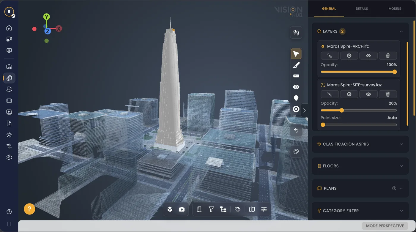
CloudCompare to analyse; VisionHub to share. You will find the other options in BIM and point cloud viewers, and why we insist on open formats in VisionHub vs Matterport.
Have you been handed a cloud and do not know where to start, or do you need a deviation check between what was built and the model? Tell us what you want to verify and we will tell you what it takes.