
Jorge Muñoz
Partner · Commercial pilot
11 years · Aerial photogrammetry
Commercial pilot, with 10 years of aviation experience and 11 years at Droneit in large-area photogrammetry and LIDAR.
Team
LAURIA ESCÁNER is a 3D LIDAR, SLAM and drone photogrammetry company with its technical base in Madrid. The team is made up of four founding partners (architecture, industrial engineering, commercial piloting and business administration) and an in-house technical team specialising in point cloud capture and processing. Between them the partners have more than 30 years of combined experience in photogrammetry, BIM, GIS and infrastructure scanning across Spain and Europe.

Architecture, industrial engineering and flight operations meet in the ownership of LAURIA ESCÁNER, after years of prior work in scanning, photogrammetry and construction monitoring before the company was founded.
Partner · Commercial pilot
11 years · Aerial photogrammetry
Commercial pilot, with 10 years of aviation experience and 11 years at Droneit in large-area photogrammetry and LIDAR.
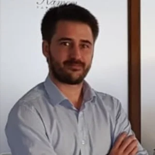
Partner · Industrial engineer
10+ years · Infrastructure
Industrial engineer and partner at BIMCoTech, with more than 10 years scanning infrastructure and industrial buildings across Europe.
Partner · Architect
8 years · Photogrammetry and BIM
Architect. Eight years working in photogrammetry, GIS and BIM, the last six as technical lead at Droneit.

Partner · Administration
11 years · Construction monitoring
Head of administration, with 10 years in business management and 11 years at Droneit in construction monitoring and flight operations.
An in-house team combining engineering, construction management and architecture backgrounds with higher-level qualifications in building and civil works, extended by a network of specialist collaborators across Spain. Everyone who processes a point cloud in the office knows the field equipment and has worked with it, and the processes are systematised so large projects stay under control and their status can be reported quickly: the data is understood and controlled from award through to final export.
From our Madrid base we process every point cloud captured on site. The capture and processing team works on workstations sized for the data volume a LIDAR scanner or a drone photogrammetry campaign generates, with no bottleneck between site, office and delivery.
High-speed internal network · the data never stalls
Input
Point clouds from LIDAR, SLAM and drone arrive from the field.
Compute
Latest-generation workstations that process multi-gigabyte clouds without bottlenecks.
Data
Sized for complete LIDAR and photogrammetric campaigns.
Output
Export in the required formats and access to the project web viewer.
Four founding partners, with backgrounds in architecture, industrial engineering, commercial piloting and business administration, plus an in-house technical team specialising in point cloud capture and processing, trained in reality capture, TLS, GNSS and total station. Between them the partners have more than 30 years of combined experience in photogrammetry, BIM, GIS and infrastructure scanning.
The team combines engineering, construction management and architecture backgrounds with higher-level qualifications in building and civil works, alongside specific training in TLS laser scanning, GNSS, total station and drone piloting for photogrammetry and technical inspection. Everyone who processes a point cloud in the office knows the field equipment and has worked with it, and the processes are systematised so large projects stay under control.
The technical base is in Madrid (Calle Castrobarto 10), with an in-house capture and processing team and project coverage across the whole of Spain.
Yes. Briefing, reporting and deliverables are handled in English for international clients, while the site work, permits and dealings with Spanish authorities are handled locally by the same team.
Tell us what you need surveyed. We review your case with no obligation and send back a technical and commercial proposal matched to your requirements — in English, working to your project timetable.