What LiDAR is
LiDAR (Light Detection and Ranging) is a technology that measures distances with laser pulses: it times how long light takes to reach a surface and come back. By repeating that measurement hundreds of thousands of times per second while the beam sweeps the scene, a LiDAR sensor captures millions of points with X, Y, Z coordinates that reproduce the real shape of a building, a terrain or an object.
It is an active measuring system: it brings its own light, so it does not depend on daylight or on the surface having texture. NOAA defines it as a remote sensing method that uses pulsed laser light to measure ranges, and describes an airborne system as three parts: the laser, a scanner and a specialised GPS receiver (plus an inertial unit that records orientation).
You will see it written as LiDAR, LIDAR or lidar; they all mean the same. A LiDAR scanner usually refers to the terrestrial unit on a tripod; a LiDAR sensor, to the module mounted on a drone, an aircraft, a car or a phone. The measuring principle is identical.
How a LiDAR sensor works
Time of flight
This is the most common method. The sensor fires a very short pulse, times how long it takes to return and applies a simple formula: distance = speed of light × time / 2 (divided by two because the light travels there and back). At 15 m that trip lasts about 100 nanoseconds, so the electronics must time events with extreme precision. Time of flight allows long ranges and is used by airborne systems and long-range terrestrial scanners.
Phase difference
Some terrestrial scanners emit a modulated continuous wave instead of pulses and calculate distance from the phase shift between the outgoing and returning wave. They measure faster and with less noise at short range, at the cost of reach. An ISPRS study of the Royal Pantheon of San Isidoro in León compares both principles on a real heritage survey.
Wavelength
Topographic LiDAR typically works in the near infrared; bathymetric LiDAR uses green light, which penetrates water, to map riverbeds and the seafloor (NOAA). In practice two bands dominate: 905 nm, with cheap, compact silicon detectors, and 1550 nm, which allows more power at the same eye safety and therefore longer range, with more expensive detectors (Inertial Labs).
Multiple returns
A laser pulse is not infinitely thin: it spreads into a small cone. If it meets a tree crown, part of the light bounces off the leaves and the rest carries on to the branches or the ground. The sensor records each echo separately: the first return is usually the highest feature (canopy, roof), intermediate returns describe the vegetation structure and the last is usually the ground, though not always: if a thick branch stops the whole pulse, the last echo is the branch. That is why airborne LiDAR can model the terrain beneath woodland, something photography cannot do. Besides position, each point stores the intensity of the echo, which helps tell materials apart.
Types of LiDAR by platform
The principle is the same; what changes is where you measure from, and that determines range, density and accuracy.
Airborne LiDAR from aircraft
It measures entire territories from hundreds or thousands of metres up and underpins national mapping. Spain’s PNOA-LiDAR, for example, covers the whole country as free open data, with a density in the order of 5 points per m² and 10 cm vertical accuracy. It is fine for terrain, context and planning, not for surveying a building. We cover it in PNOA-LiDAR and Spain’s third coverage.
Drone LiDAR
The same principle, but a few dozen metres above the ground. It delivers more than a million points per hectare, 2-3 cm accuracy with RTK or ground control points and up to 600 ha in a single day, and records the terrain beneath vegetation. It is the option for surveying large areas, linear infrastructure, slopes or quarries: drone LiDAR mapping.
Terrestrial laser scanning (TLS)
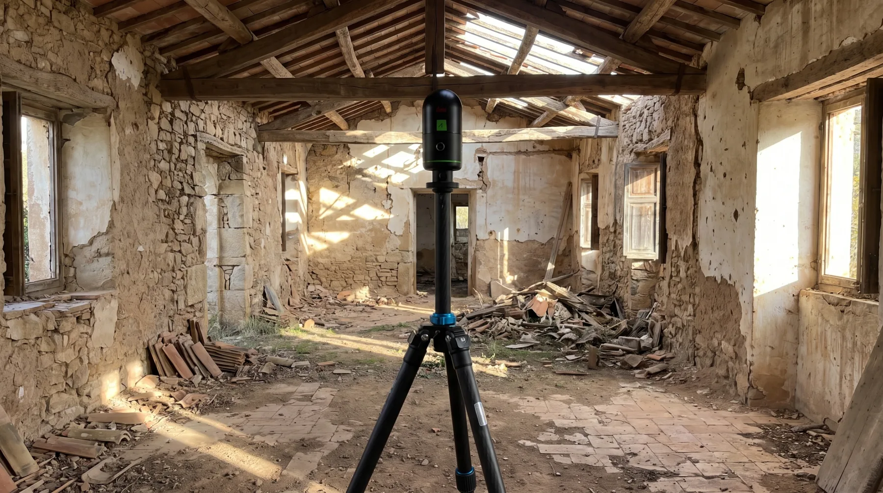
A scanner on a tripod that measures station by station, like the one in the header photo. It is the most accurate option: we work with a nominal accuracy of ±2 mm under controlled conditions. It is the standard for interiors, façades, structure, building services and heritage: 3D laser scanning.
Mobile LiDAR and SLAM
The sensor is handheld, in a backpack or on a vehicle, and measures continuously while you walk. The SLAM algorithm (simultaneous localisation and mapping) works out the trajectory from the cloud itself. It is far faster than a tripod on long routes (galleries, warehouses, tunnels, historic sites), with an accuracy in the order of 1 to 3 cm depending on the equipment, the route and the control points.
Other LiDAR
Bathymetric LiDAR maps shallow seabeds with green light; the LiDAR on autonomous vehicles and robots detects obstacles in real time. They do not produce survey deliverables, but they share the same measuring principle.
iPhone and iPad LiDAR
iPad Pro and iPhone Pro models have carried a LiDAR sensor since 2020. According to Apple, it measures the distance to objects up to 5 metres away, indoors and outdoors. Its main job is to improve augmented reality, low-light autofocus and measuring apps.
How well does it actually measure? A study published in Scientific Reports using the iPhone 12 Pro found around ±1 cm on small objects (over 10 cm per side) and ±10 cm on large models, such as a 130 m coastal cliff. Density drops quickly with distance: from about 7,000 points per m² at 25 cm to about 150 points per m² at 2.5 m.
Our honest take: it is good for measuring a room, sketching, estimating an area or quickly documenting a condition. It is not good for a professional survey: the range is short, error builds up across large spaces, there is no controlled registration or georeferencing, and nobody signs an accuracy report. A design project, a tender or an as-built needs a terrestrial or SLAM scanner.
What it produces: the point cloud
The direct output of any LiDAR is a point cloud: millions of measurements with coordinates, intensity and, if the unit has a camera, colour. Once registered and, where needed, georeferenced, it becomes the base to measure on and to build everything else:
- Terrain and surface models (DTM, DSM), contours and profiles.
- Existing-condition drawings: plans, sections and elevations.
- As-built BIM models (Scan to BIM) and digital twins.
- Measurements: volumes, clearance checks, deformation monitoring.
The cloud is delivered in open formats: E57, LAS/LAZ and, for Revit and AutoCAD, RCP. We explain what each point and each format stores in what is a point cloud. To share it without downloading gigabytes, a web viewer such as VisionHub opens it in the browser alongside the IFC model.
Accuracy: what to expect
These are the indicative figures we work with. The real accuracy of each project depends on the equipment, the registration and the control points:
- Terrestrial scanner (TLS): ±2 mm nominal under controlled conditions.
- SLAM: in the order of 1 to 3 cm.
- Drone LiDAR: centimetre-level, 2-3 cm with RTK or ground control points.
- National airborne LiDAR: decimetre-level (around 10 cm vertical in programmes such as PNOA).
Do not confuse accuracy (how close each point is to its true position) with density (how many points there are per area). More points show more detail, but they do not make the cloud more accurate. And the figure that matters is not the one on the scanner datasheet but that of the registered dataset: always ask for the registration report.
LiDAR vs photogrammetry
Photogrammetry also produces point clouds, but calculates them from overlapping photographs instead of measuring them with a laser. The two complement each other:
| LiDAR | Photogrammetry | |
|---|---|---|
| How it measures | Distance with its own laser | Geometry calculated from photos |
| Beneath vegetation | Yes, with multiple returns | No: it only sees the canopy |
| Textureless surfaces | Fine (water aside) | Poor: not enough tie points |
| Light | Independent | Needs good light |
| Colour | If a camera is added | Excellent, with orthophoto |
| Best for | Wooded terrain, interiors, building services | Roofs, façades, open quarries, orthophotos |
On the same project it is common to fly LiDAR for the terrain and photogrammetry for the orthophoto, and to scan the interiors with a terrestrial laser scanner.
What LiDAR is used for
- Architecture and refurbishment: existing-condition surveys, as-builts, heritage.
- Engineering and infrastructure: roads, rail, canals, tunnels, dams, deformation monitoring.
- Surveying and civil works: DTMs, volume calculations, earthworks tracking.
- Industry: plants, services and pipework before a refit or an extension.
- Land and environment: forest inventory, flood zones, power lines.
- Forensics and loss adjusting: documenting a scene or an incident as it stands.
Summary table
| Type | Platform | Indicative accuracy | Best for |
|---|---|---|---|
| Airborne | Aircraft | Decimetre-level | Territory, context, planning |
| Drone LiDAR | Drone with RTK | 2-3 cm | Surveying, linear infrastructure, terrain under vegetation |
| Terrestrial (TLS) | Tripod | ±2 mm nominal | Interiors, façades, structure, building services |
| Mobile / SLAM | Handheld, backpack, vehicle | 1-3 cm | Long routes, galleries, warehouses |
| Consumer mobile | iPhone / iPad Pro | ±1 cm on small objects; ±10 cm on large scenes (study) | Measuring a room, sketches, augmented reality |
How to commission a LiDAR survey
At LAURIA ESCÁNER we do not sell equipment: we do the whole job. We capture with a terrestrial scanner, SLAM or drone depending on what needs measuring, we process and register the cloud, and we always deliver it in open formats; drawings, the BIM model or the digital twin, as commissioned. We are based in Madrid and work across Europe.
If you have a building, a plant or a site to measure, tell us what it is for and how accurate it needs to be: we will tell you which type of LiDAR fits and which is overkill.