Laser scanning · LIDAR · SLAM · Drone · AI

LAURIA
ESCÁNER

LIDAR laser scanning and photogrammetry
for digital twins, BIM and GIS

A reality capture company based in Madrid, surveying anywhere in Spain. We produce georeferenced point clouds with millimetre accuracy for infrastructure, heritage and building projects — and we run them in English, for clients whose office is somewhere else.

±0.02cm
LIDAR accuracy
360°
Full coverage
+200
Projects delivered
LIDAR · SLAM · AI · φ 1.618

Millimetre-accurate technology
for every project

We combine the most advanced capture systems available with artificial intelligence, for results that are faster, more accurate and easier to work with than a conventional survey.

Drone LIDAR & Photogrammetry

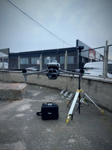
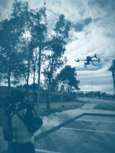
Aerial surveys flown with LIDAR sensors and high-resolution cameras. Large areas covered at configurable point density, with textured photogrammetric models, orthophotos and terrain models as standard outputs.

Aerial LIDAR Photogrammetry Drone Orthophoto
View service

Gaussian Splatting

Photorealistic scene reconstruction with Gaussian Splatting, the current state of the art in 3D scene synthesis. Extremely high visual fidelity from imagery or video, ready for web viewers and VR headsets.

3DGS NeRF Photorealism WebGL
View service

Reality Capture & Digital Twins

Accurate digital twins built from LIDAR and photogrammetric data. Integration with BIM platforms, GIS and real-time rendering engines, with recapture cycles to keep the twin aligned with the asset over its life.

Reality Capture Digital Twin BIM GIS
View service

Scan to BIM & GIS Mapping

As-built BIM models in Revit, ArchiCAD and other packages, modelled from the point cloud to an agreed LOD. Accurate GIS mapping for urban planning and infrastructure. Delivered in IFC, RVT, DWG, SHP and open formats.

Revit IFC ArcGIS As-built
View service

Our Own Point Cloud Viewer

An in-house platform for viewing and analysing point clouds, Gaussian Splatting models and BIM data in one place, in the browser. No installation, usable from any device, and shared with your team through a controlled link.

WebGL Point Cloud 3DGS viewer BIM viewer
View software

Numbers that do not lie

Our terrestrial LIDAR scanners reach an accuracy of ±0.02 cm under controlled conditions, and better than ±1 mm on precision engineering work. Georeferencing is done with GNSS RTK or by tying into official Spanish survey networks.

Point density, angular coverage and maximum range are configured per project: from a single industrial component to kilometres of linear infrastructure.

±0.02cm
Nominal accuracy
terrestrial LIDAR
2Mpts/s
Maximum capture
rate
360°
Full angular
coverage
300m
Maximum range
per station

We work in sectors
where geometry is critical

Millimetre-accurate point clouds and open delivery formats let us fit into any sector with demanding metric requirements — and into whatever software your own team already runs.

Architecture & Heritage

Surveys of historic and contemporary buildings. Heritage documentation, as-built BIM and high-fidelity drawings for restoration and refurbishment projects.

View sector

Infrastructure

Scanning of bridges, viaducts, tunnels, roads and rail. Structural inspection, deformation monitoring and asset models for predictive maintenance.

View sector

Water Infrastructure

Dams, reservoirs, canals, pipelines and treatment plants. High-accuracy models for hydraulic calculation, inspection and water asset management — the niche where most of our reference work sits.

View infrastructure

Urban Planning & Land

Photogrammetric and LIDAR drone flights for DTM, DSM and orthophotos: planning applications, flood studies and GIS analysis of the territory.

View sector

Industrial & Process Plants

Scanning of industrial facilities, chemical plants, refineries and factories. Pipework and structural models for maintenance, expansion and as-built documentation of production processes.

View sector

Archaeology & Geology

Documentation of archaeological sites, caves and geological formations. High-density point clouds for stratigraphic analysis, conservation and public interpretation.

Facility Management

Digital twins for the efficient running of buildings and facilities. As-built BIM models kept current for operation, maintenance and refurbishment planning.

Energy & Renewables

Inspection and modelling of wind farms, solar plants, substations and transmission lines. Shading analysis, as-installed verification and documentation for certification.

See your project
from day one

We have built our own viewer that brings point clouds, Gaussian Splatting models and BIM data together in a single web environment. Nothing to install, usable from any device, with per-project access control — which matters when the reviewing team is in another country.

Point Cloud Viewer BETA
Interactive exploration of point clouds with millions of vertices, straight in the browser. Measurements, sections, annotations and data export.
Gaussian Splatting Viewer
Real-time rendering of photorealistic 3DGS models. Free first-person navigation at cinematic quality.
Integrated BIM Viewer
IFC/BIM models displayed over the point cloud, so deviations between the model and the built reality are visible rather than assumed.
Secure Sharing
Per-project access with permission control. Your clients and consultants open the model from a link, with no specialist software at their end.
LAURIA VIEWER · POINT CLOUD · LIVE DEMO
Three.JS LAZ / LAS IFC Fragments 3DGS

From scanner to deliverable
in record time

01
Technical brief
Project review, critical areas, accuracy requirements, coordinate system and choice of the right capture system. Handled remotely for clients outside Spain.
02
Site capture
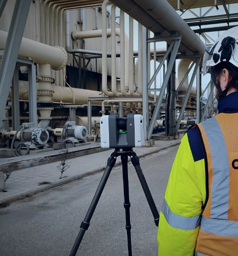
Scanning with terrestrial LIDAR, mobile SLAM or drone as the asset demands. Georeferencing with GNSS RTK.
03
Processing and registration
Automatic and manual registration of scans. Noise filtering, point classification and final georeferencing.
04
Modelling and analysis
As-built BIM models, Gaussian Splatting, 3D meshes, orthophotos and 2D drawings, to the deliverable list agreed up front.
05
Delivery on the platform
Immediate access to the web viewer with all project data, plus file downloads in the formats you require.

Never seen a point cloud before? Both processes are explained end to end, animated:

Your questions, answered

The key concepts behind 3D capture, so you can pick the right approach for your project before you brief anyone.

Do you work with international clients on projects in Spain?

Yes. A large part of our work is delivered for engineering firms, infrastructure operators, heritage bodies and property investors based outside Spain that need an asset captured here. We handle site logistics, permits and local coordinate systems, report in English, and deliver in the formats your own team already uses — so nothing about the project needs managing from abroad except the brief.

What is 3D laser scanning and what is it used for?

3D laser scanning (LIDAR, Light Detection and Ranging) emits laser pulses to measure distances with millimetre accuracy. It produces georeferenced 3D point clouds that document the geometry of buildings, infrastructure or terrain exactly as built. Typical uses are as-built surveys for BIM, structural inspection, digital twin modelling, GIS mapping and heritage documentation.

What is the difference between photogrammetry and LIDAR?

The difference is the capture method. LIDAR is an active system: it emits laser pulses to measure exact distances, penetrates vegetation and works without daylight. Photogrammetry is passive: it reconstructs 3D from photographs, which is excellent for visual texture but depends on lighting and is less accurate on complex geometry or dense vegetation.

How much ground can drone LIDAR cover?

Our drone-mounted LIDAR systems cover large areas quickly. Under good conditions we survey up to 500 hectares per day at a point density above 100 pts/m², producing high-accuracy topography for major infrastructure or urban development schemes.

When should SLAM be used instead of a terrestrial scanner?

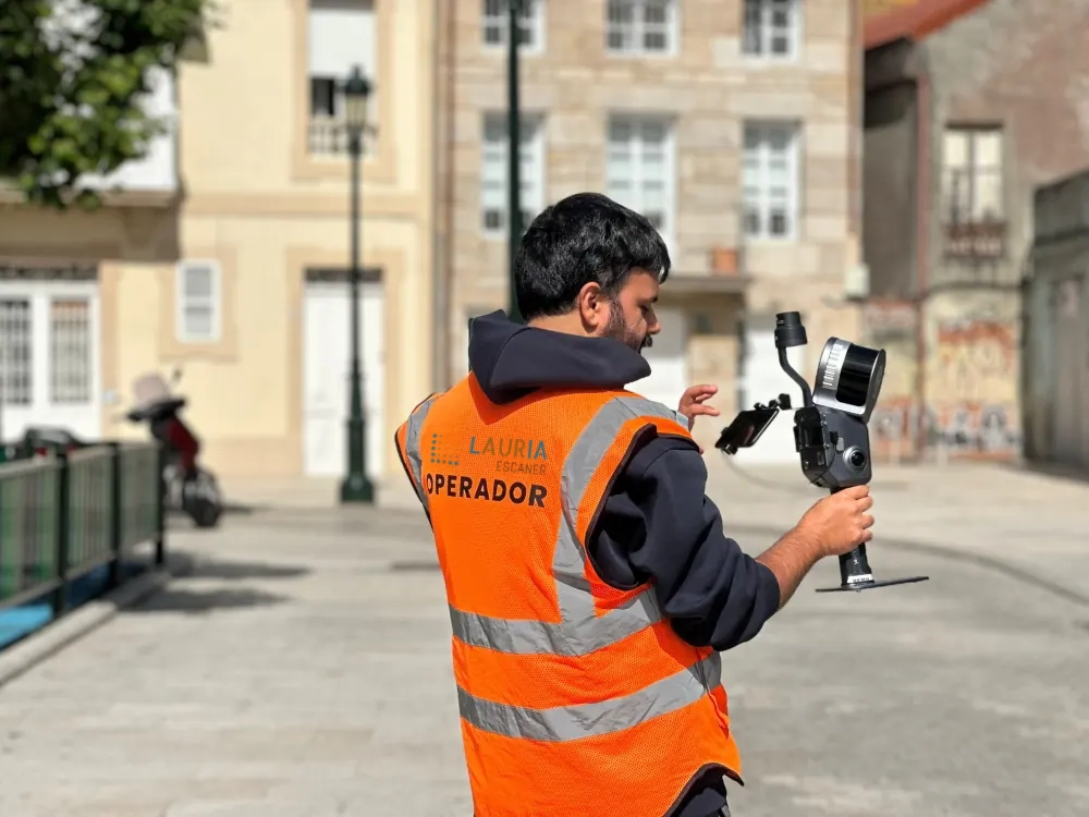
A terrestrial scanner on a tripod gives maximum accuracy (millimetre) and density, which suits architectural and industrial detail. A SLAM system captures while walking, is up to 10× faster, and is ideal for complex environments, large interiors or sites where occupation time is critical, while still holding accuracy in the 1–2 cm band.

What is Gaussian Splatting and how does it differ from photogrammetry?

Gaussian Splatting (3DGS) is an AI-based 3D reconstruction technique that represents the scene as millions of volumetric gaussians, producing photorealistic results rendered in real time. Traditional photogrammetry derives point clouds, meshes, DTMs, DSMs and orthophotos from imagery with metric accuracy, but without hyper-realistic visual quality. Gaussian Splatting does not measure; it lets you explore the model at cinematic quality in a web viewer or in VR, which suits presentations for architecture, heritage and property.

Do you travel outside Madrid?

Yes. Our technical base is in Madrid, and we scan across the whole of Spain: regular work in Valencia, Barcelona, the Basque Country and Zaragoza, and travel to any other province on a fixed quote that includes mobilisation. Capture usually takes one or two days on site and processing happens in the office, so distance affects neither the programme nor the quality.

Have a site in Spain
that needs capturing?

Tell us what you need surveyed. We review your case with no obligation and send back a technical and commercial proposal matched to your requirements — in English, working to your project timetable.

Email hola...
Coverage Spain · International clients