How a building is scanned in 3D

From laser pulse
to 3D model

An existing building is not drawn: it is measured. A laser scanner takes millions of measurements of what is really there — that is the point cloud — and the 3D model is built on top of it. Three stages: capture on site, merging every scan, and modelling.

Scroll

o pasa de fase con ← →

The whole process in a single take

01 — Site capture

The head turns, the mirror sweeps

The scanner is set up on a tripod and rotates 360° horizontally while an internal mirror sweeps the vertical plane at thousands of revolutions per minute. Each laser shot travels to the surface and back: the time of flight gives the distance; the position of the head and the mirror give the two angles. One distance plus two angles is already a coordinate. The scene resolves point by point as the sweep advances.

When the sweep closes, three integrated cameras cover the same sphere in HDR. That colour is projected onto each point afterwards, which is why the cloud does not look like a drawing but like a photograph with volume. The procedure is the same on any asset, from the inside of a process plant to a listed façade.

2M Points / second
1.9 mm Accuracy at 10 m
360°×300° Field of view
0.5 – 130 m Laser range

02 — Registration and point cloud

Every scan, one single cloud

No single station sees the whole building: dozens of positions are needed to leave no shadows. Registration is the operation that brings them all into one reference system, fitting the overlapping zones until the surfaces coincide. The result is no longer separate scans but a continuous point cloud, where every façade, cornice and floor is described by millions of coordinates. Measurement replaces interpretation.

  • Cloud-to-cloud registration supported by targets and survey control
  • Georeferencing to the project's official coordinate system
  • Noise filtering, removal of moving objects and density unification
  • Closure error report: accuracy is documented, not assumed
  • Delivery in E57, LAS/LAZ, RCP and LGS

03 — Modelling and delivery

Model, cloud and map, in the same coordinates

Modelling does not interpret freely: it fits volumes to the cloud. Every wall, column and slab is built on the real measurement, with its lean and its variable thickness where it has them. The same data is consulted as superimposed layers that coincide in coordinates. Pull them apart and you see what the digital twin is made of.

03
Modelled geometry Walls, slabs and columns fitted to the cloud, with the tolerance stated in writing
02
Registered point cloud The raw measurements, exactly as they came off the scanner
01
Base mapping Georeferencing in the project coordinate system

Result

A model that can be checked

The advantage of chaining the three stages is traceability. Any dimension in the model can be compared with the points it came from, and that comparison is delivered as a deviation map. You do not have to believe the model: you can verify it. We work this way across the whole of Spain, from our technical base in Madrid.

In short

How LIDAR scanning works, stage by stage.

LIDAR laser scanning measures an existing building rather than drawing it: the scanner fires a laser beam millions of times and, from the time of flight of each reflection plus the two angles of the head and the mirror, derives an X Y Z coordinate. The 3D scanning process chains three stages. The result supports refurbishment design against the real state, area and section measurement, as-built BIM modelling, verification of completed works and heritage documentation — with no manual re-measuring.

01
Site capture
A 360° × 300° sweep from each station, up to 2 million points per second, with HDR colour projected onto each point afterwards.
02
Cloud registration
The dozens of stations needed to leave no shadows are brought into a single reference system, and whatever does not fit between them — the closure error — is documented in millimetres.
03
Modelling and delivery
The BIM model volumes are fitted to the cloud and delivered with it and the base mapping as coincident layers, with a deviation map.
Leica RTC360 terrestrial laser scanner specifications and output formats of the process
ParameterLeica RTC360
Capture rate2,000,000 points per second
3D point accuracy1.9 mm at 10 m
Field of view360° × 300°
Measuring range0.5 – 130 m
GeoreferencingThe project's official coordinate system
Cloud formatsE57 · LAS/LAZ · RCP · LGS
Model formatsRVT · IFC

Leica RTC360 specifications as published by the manufacturer.

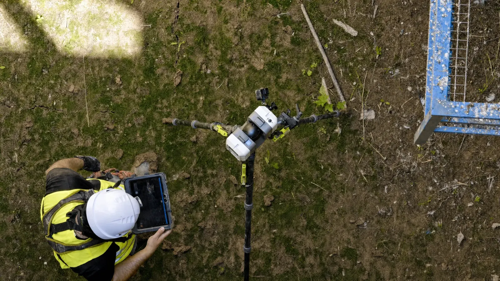
LAURIA ESCÁNER technician reviewing the point cloud on a tablet beside a Leica RTC360 laser scanner set up on a tripod
Leica RTC360 on site · reviewing the cloud on a tablet
FAQ

Questions about the scanning process.

What is a point cloud?

It is the set of coordinates a laser scanner returns: millions of points, each with its X Y Z position and its colour, which together describe the exact shape of what was measured. It is not a photograph, and not a hand-drawn plan: it is the measurement itself. Any distance, level or section can be taken from it without going back to the building.

Why scan a building in 3D?

To work from what actually exists rather than from old drawings: refurbishment and restoration design, reliable areas and measurements, sections and elevations, as-built BIM models, verification of completed works, heritage documentation and expert reports. Every team consults the same cloud and measures on it, without travelling to the building again.

How does a laser scanner measure distance to a surface?

The scanner fires a laser beam and measures how long the reflection takes to return: the distance follows from that time of flight. The position of the head gives the horizontal angle and the internal mirror the vertical one. One distance plus two angles define an X Y Z coordinate, and the scene resolves point by point as the sweep advances.

What is point cloud registration?

It is the operation that brings every scan station into a single reference system, fitting the overlapping zones until the surfaces coincide. No single station sees the whole building, so dozens of positions are needed to leave no shadows; registration turns them into one continuous cloud and documents the closure error in millimetres.

How many points per second does a terrestrial LIDAR scanner capture?

The terrestrial scanner we use, a Leica RTC360, captures up to 2 million points per second, with a 3D point accuracy of 1.9 mm at 10 m, a 360° × 300° field of view and a measuring range of 0.5 to 130 m.

In which coordinate system and formats is the point cloud delivered?

Georeferenced to whichever official coordinate system the project uses — agreed before capture and integrated with the client’s survey control or GIS — and delivered in E57, LAS/LAZ, RCP and LGS. The derived model comes out in RVT and IFC, at the agreed level of information.

How is the 3D model checked against the measured reality?

By comparing the model with the points it came from. That comparison is delivered as a model-to-cloud deviation map in millimetres, so any dimension in the model is traceable back to the field measurement behind it.

Seguir

From the process to the actual service.

Contact

Have a site in Spain
that needs capturing?

Tell us what you need surveyed. We review your case with no obligation and send back a technical and commercial proposal matched to your requirements — in English, working to your project timetable.

Email hola...
Coverage Spain · International clients